Hiking Quieter Trails
Jan 16, 2021
Beginning last fall, I've been exploring day hike trails near me that I've never been to before. My intent was to explore trails that were a little more off the beaten path because of Covid concerns, and close to San Jose. Most of these I could reach with my 2015 Nissan Leaf that only has a range of about 50 miles. These trails also worked well with the cool dry weather we've been having in the area. Many have lots of sun exposure or would be muddy after rainfall. The following is the short list of some of those hikes that I've done lately which I'd recommend.
Wilder Ranch, Baldwin + Enchanted Loop
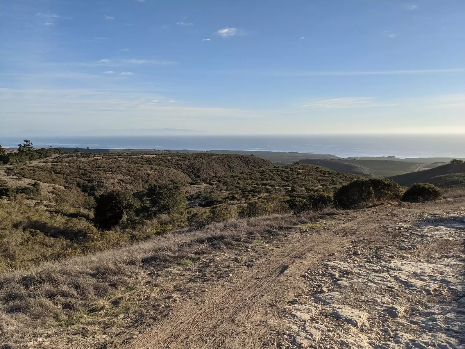
This was probably my favorite listed here. The start of the trail on the Baldwin loop climbs from Hwy 1 up onto an exposed ridgeline with sweeping views of the Pacific Ocean. We traversed this trail clockwise, and I think that gives a little bit longer of a view as you return to your car facing the ocean. It also makes the short maximum grade sections uphill.
Once you reach the intersection with the Enchanted Loop trail, you can choose to cut your hike short, making it a simple 3.2 mile loop with moderate 600ft elevation gain. However, I would strongly recommend adding on another 1.9 miles for the Enchanted Loop trail which is fairly level except for a few short sections.
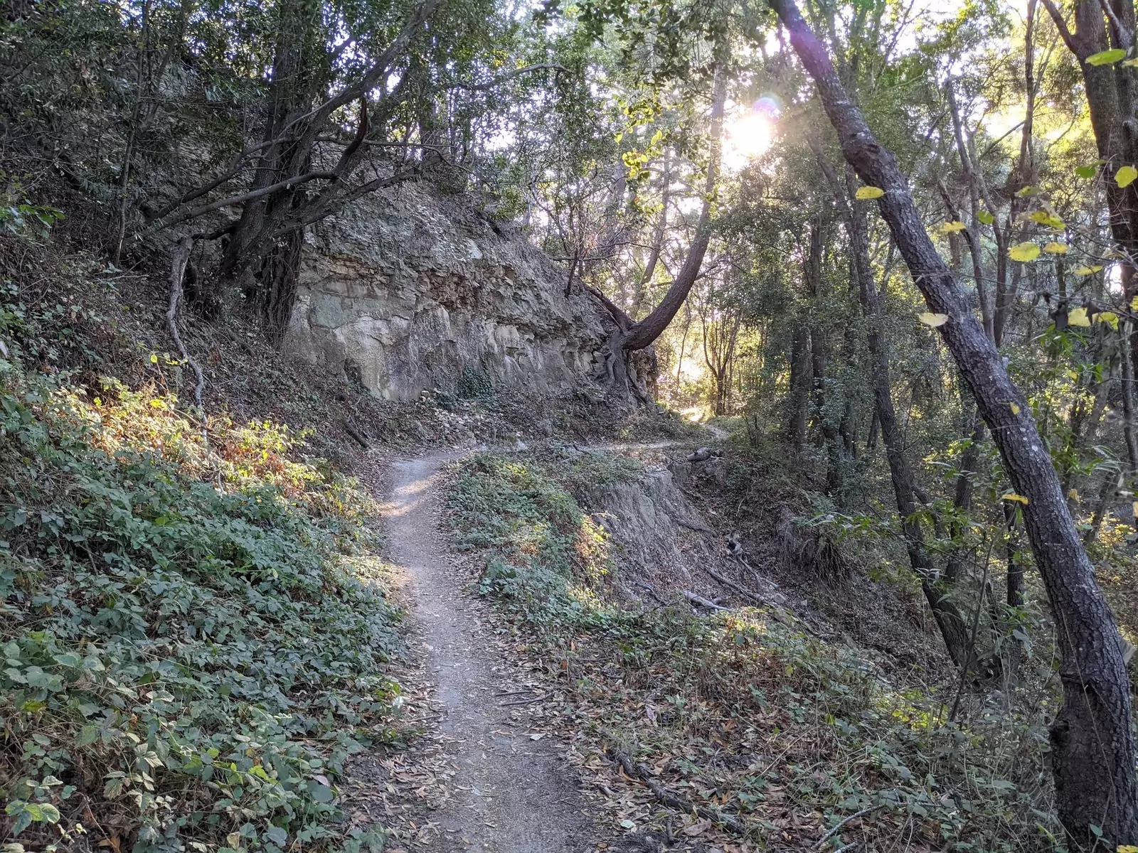
The Enchanted Loop trail has an entirely different character to the section you will have traversed so far. Up until now, you've been walking along grassy hills with sweeping views. Immediately after starting on the Enchanted Loop, you drop down the inland side of the ridge into a fairly dense Redwood and Oak forest. The trail mostly meanders through a dark valley. We saw fairly few others along this section, which made it rather tranquil. One person we ran into was foraging some mushrooms from the side of a tree trunk.
The furthest east section of the trail had some brush that appeared recently burned from the fires in the area, but the trail was not impacted in any way and was easy to follow.
The trailhead was not well marked, though it wasn't hard to find or navigate. You have to park in an unmarked dirt parking lot off the side of Hwy 1 and then cross by foot and walk a short distance down what looks like a private road. The parking lot is not signed for Wilder Ranch, which has it's own parking lot to the South. I recommend making sure you have the parking lot dialed into a GPS before you get there.
Snell Barn Loop
This one is a very flat stroll in Joseph D. Grand County Park. I've driven past this several times on the way up to Mt Hamilton, but never stopped. Nor do many others it seems.
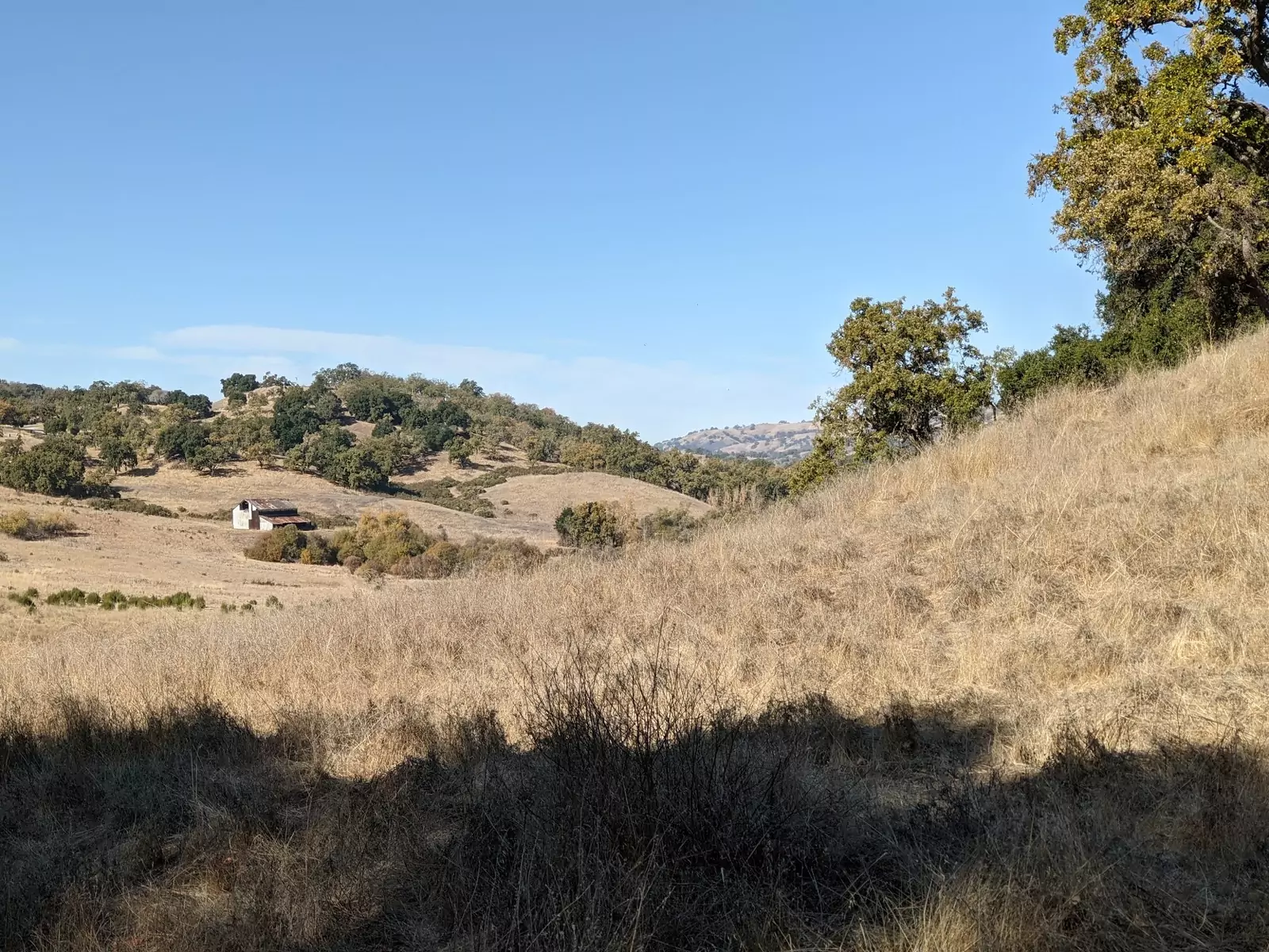
The trail is a leisurely 4mi loop around the edges of an open meadow with an old abandoned barn sitting in the middle. It's a rather picturesque landscape. There are a good number of massive live oak trees dotted along the trail. Due to it's location and lack of visitors, we saw quite a lot of wildlife along the trail. Quail, Deer, Turkey, and even some wild pigs in the bushes. I didn't get a good look at the pigs. We heard them before we spotted them.
Despite the beautiful trees, this is mostly an exposed trail and would be hot in the summer. Some parts also run over fairly low points in the meadow, so I imagine that it could get muddy after a good rain.
I did walk past some of the trail intersections at a few points, and my GPS started beeping at me. There was some signage, so I'm not sure if I was just absent minded that day or it was hard to spot. I don't think it would be possible to get seriously lost though.
Calero County Park Loop
My planned route was a leisurly short loop starting from the parking lot without much elevation. In total, I think it's around 400ft of elevation gain over 3 miles, with broken up short moderate grades. Route:
- Start at the parking lot in Calero County Park. Head down Oak Cove trail, climbing <100ft over 0.2 miles.
- Turn left onto the Figueroa trail. This section is cooler as it follows a creek and has lots of shade. Climbs unnoticeably 150ft over 1.5mi.
- Turn right onto the Vallecito trail which climbs 150ft along a single track for 0.5 miles.
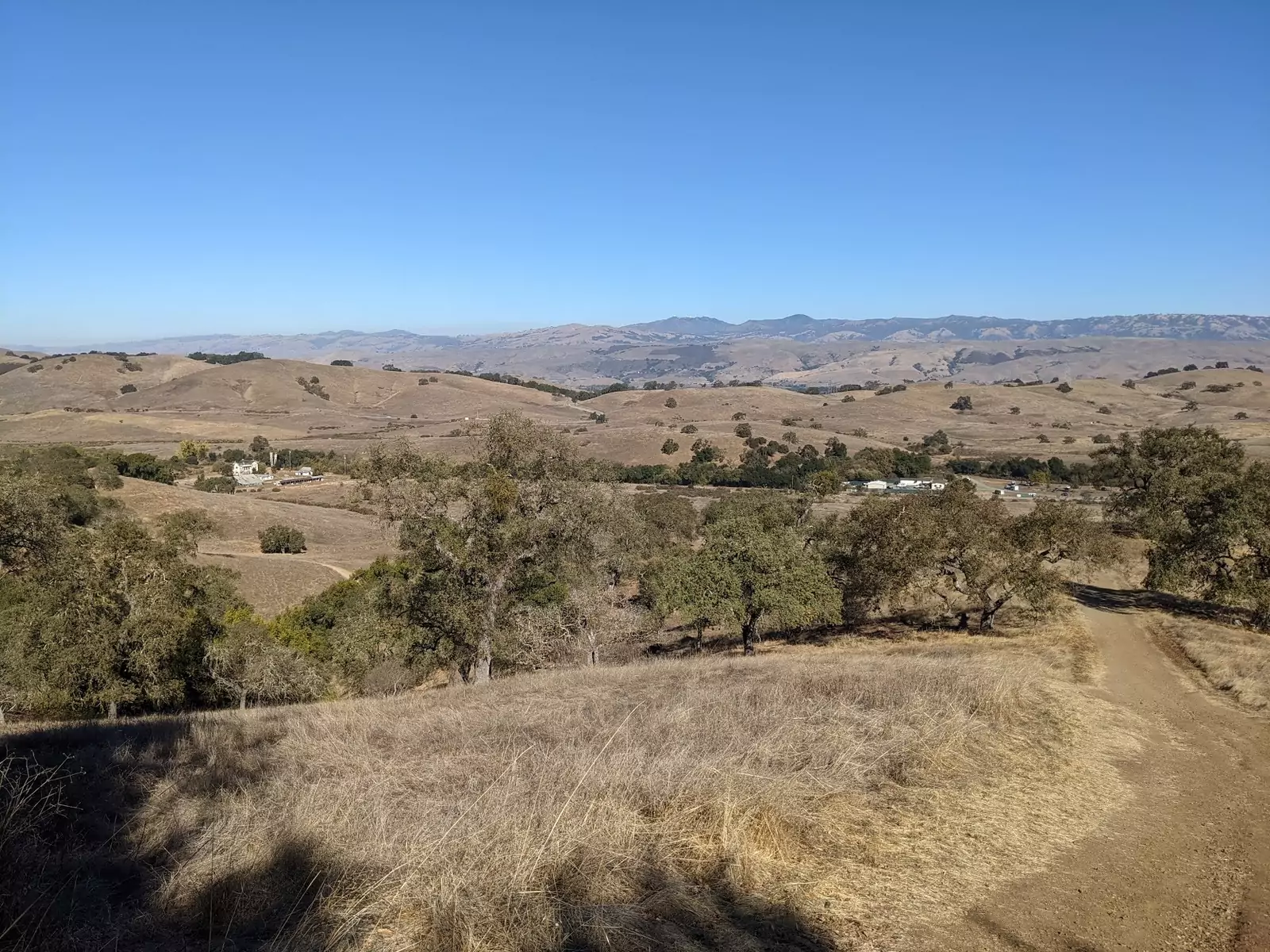
- Turn right onto the Pena trail which climbs 100ft to a hilltop with a nice view and a good shady spot to have a snack or packed lunch. This is followed by a moderate descent of about 300ft. Overall, about 0.25 miles.
- Turn right back onto the Oak Cove trail to head back to the parking lot. There is a small ridge you have to climb up, about 100ft, and the rest is a descent. 0.5 miles back to the parking lot.
This wasn't particularly memorable, but it was a decent trail with some mild highlights, and a short drive. If I were to return, I would bring lunch to sit on the rocks under the live oaks at the top of the hill on Pena trail.
Devil's Slide
This trail is a bit different than the other three. It is very popular, but due to limited parking it's not packed. Since the trail is as wide as a highway it's pretty easy to socially distance.
Devil's slide is actually an old section of Hwy 1, and you will be walking along a paved highway road. This section of Hwy 1 was frequently needing repairs due to the sheer cliffside it's carved into. In 2013, it was replaced with a tunnel and cars were no longer able to drive along it. At that time it was converted into a multi-use trail.
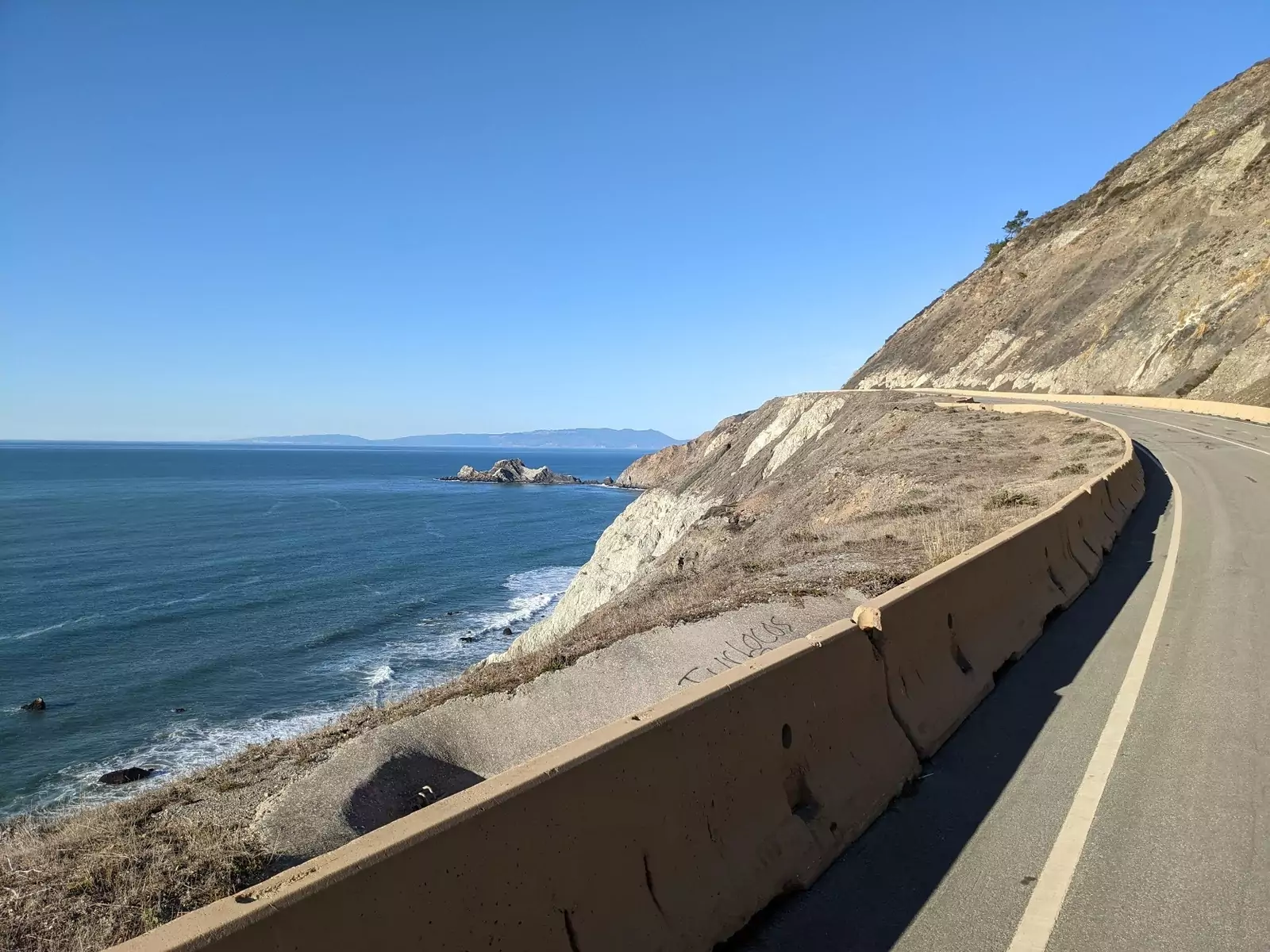
This is a short, 2.5 mile out and back along a paved road. Usually I wouldn't have any interest in that kind of thing, but the location is incredibly scenic and rather unique. See some of the photos and video on HikingProject to get an idea of what you are in for.
As I mentioned above, the parking is very limited. There are parking lots on both ends, but I found them to be both completely full with a line of cars waiting for an empty spot. I waited about 30 minutes for a spot to open up, but it was worth the wait. I would recommend against trying to park cars on both ends to do this hike one-way. The logistics are just too annoying and the hike is rather short. You could always go out and back a shorter section if you wanted to and still see the views.

Blog of Greg Grothaus.
Software Engineer at Google. Outdoor adventurer type. Opinions expressed here are mine alone.